Exploring the Majesty of the Continental Divide Inspired by Walt Whitman
Written on
I traverse a clearing that unveils breathtaking vistas of the Continental Divide. Towering peaks loom in the distance, far beyond the nearby Kenosha Mountains. On the slopes, bristlecone pines cling to ridges, their caramel-hued bark shaped by countless years of wind and erosion. These ancient trees, which can live for up to 2,500 years, symbolize the fleeting nature of existence. When their seeds first sprouted, the United States had yet to lay claim to this land; the city of Troy was still a dream, and the foundational texts of our current religions had yet to be penned.
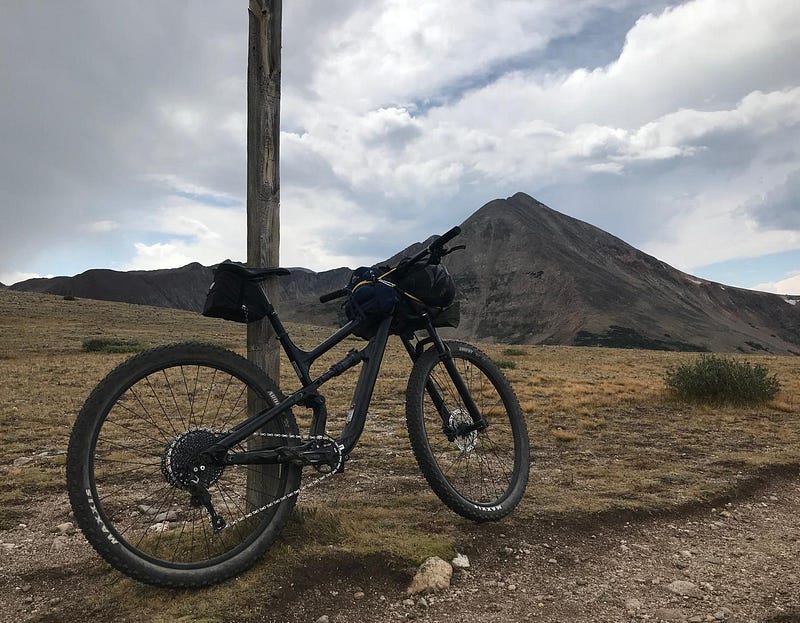
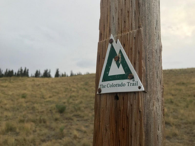
As I ride past the bristlecones, strands of mountain brome sway gently in the breeze. I descend through clusters of trees to the summit of Kenosha Pass, where tourists gather, snapping photos and adjusting their backpacks along the roadside. Vehicles, laden with mountain bikes and gear, line the pass, while semi-trucks rumble over the mountain, their engines groaning under heavy loads. I cross the pavement and escape the clamor of Highway 285, returning to the rich, loamy earth as I embark on Segment 5 of the Colorado Trail.
Pedaling through the forest, I ascend to a vantage point just above Kenosha Pass. In the distance, Highway 285 cuts a straight line across the expanse of the South Park Basin, its unnatural symmetry standing out against the landscape, softened by the hazy atmosphere. My gaze returns to the Continental Divide, a place once visited by the poet Walt Whitman. In his book, Specimen Days, he wrote:
> I jot these lines literally at Kenosha summit, where we return, afternoon, and take a long rest, 10,000 feet above sea-level. At this immense height the South Park stretches fifty miles before me. Mountainous chains and peaks in every variety of perspective, every hue of vista, fringe the view, in nearer, or middle, or far-dim distance, or fade on the horizon.
I take a moment to admire the mountain peaks. The smoky sky lends them a layered, textured beauty, their surfaces adorned in myriad shades of blue.
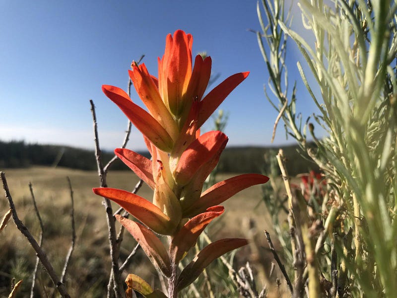
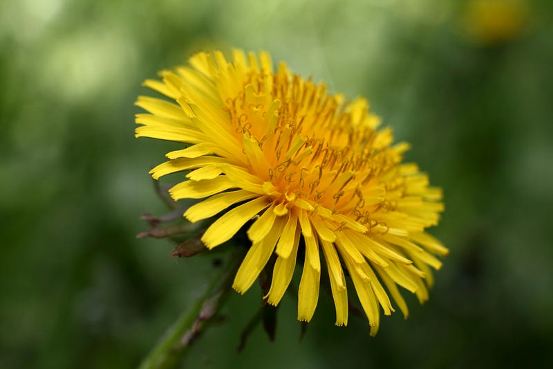
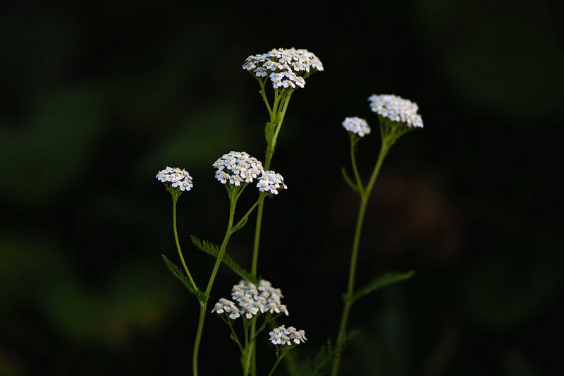
The sound of rubber on rock fills the air as I glide into a sunlit meadow. Vibrant red paintbrush flowers bloom among pale mountain dandelions, subalpine daisies, mountain sunflowers, and clusters of white yarrow, resembling small, low-lying clouds.
As I descend the trail, the meadow transitions back to the forest, leading me to the floor of a wooded gulch where I stop to hydrate from a shallow stream. The water runs clear and swift over a bed of smooth, colorful pebbles, while the scent of pine envelops the area. Insects hover above the water, birds serenade the scene, and sunlight filters through the aspen and evergreen canopies. Dipping my water bag into the stream, I filter the refreshing liquid into my bottles, the sound of the babbling creek resonating like music. The cool water on my hands reminds me of Barry Lopez's words: “To put your hands in a river is to feel the chords that bind the earth together.”
After rising from the stream, I mount my bike and head west, soon feeling water trickling down my back. Upon inspection, I discover a small stream leaking from my reservoir, caused by a tiny hole surrounded by scratches on the plastic. The droplets bead on the dark soil beneath me, transforming it into mud. I attempt to seal the leak with waterproof tape, but the patch fails to hold. Watching precious water slip away, I decide to drink as much as I can before reaching Breckenridge, a ski town along the Colorado Trail, where I can better fix my reservoir.
Thus, I continue along the trail, feeling heavy with water.
As I ascend Georgia Pass with a lighter load, the grandeur of the Continental Divide humbles and inspires me. The daunting path ahead toward Durango is both intimidating and inviting. Climbing into the high alpine regions, I find myself surrounded by the true giants of the mountains, their lower elevations blanketed with lodgepole pines, aspens, Douglas firs, Engelmann spruce, and Colorado blue spruce. I weave through conifers and past white metavolcanic boulders, making my way to the summit of Georgia Pass.
Biking soon turns to hiking, which quickly transforms into a slow, labored ascent. The discomfort of saddle sores sets in, a consequence of my ambitious start on the Colorado Trail in Waterton Canyon, where I envisioned gliding effortlessly up and down mountains. Now, I find myself struggling up Georgia Pass, feeling as though I've been riding for days. The pain in my thighs intensifies, compounded by fatigue and hunger, as well as the rising elevation, gradually taking a toll on my resolve.
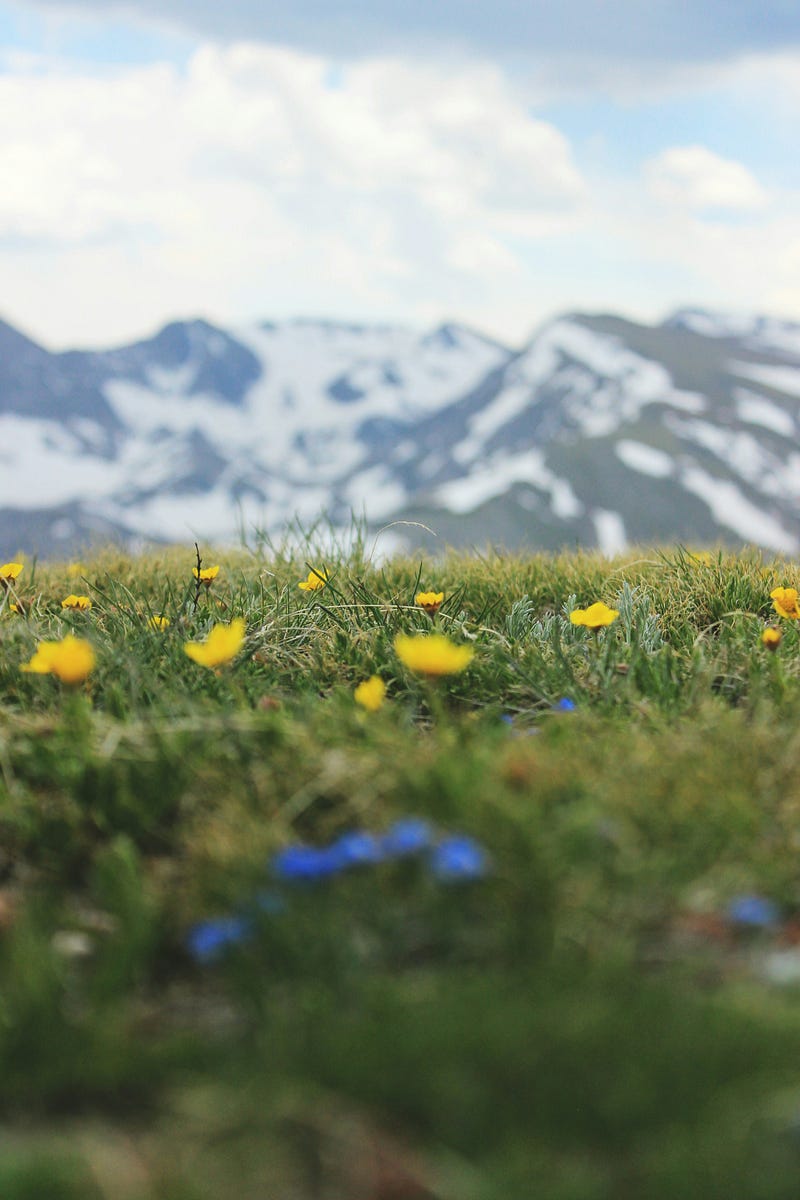
I continue along the path, the temperature dropping as I ascend above the pines, maneuvering my bike across the tundra. The green and yellow grasses of the high country stretch toward the horizon, creating an undulating sea beneath the towering peaks. Dark clouds gather to the west, casting shadows swiftly across the valleys. Bright purple asters and vibrant blue sky pilots stand out against the green tundra, accompanied by clusters of mountain bluebells blooming along the streams that trickle down the mountainside. Chipmunks dash across the trail, seeking refuge in their burrows, possibly startled by my presence or the red fox trotting across the tundra, eyeing me curiously as I push toward Georgia Pass's summit.
The tundra is a patchwork of granite and limestone, with jagged rocks jutting from tussocks of grass. The Mosquito Range's high summits pierce the clouds, their ridgelines forming bowls in the terrain where small patches of snow cling to the slopes. A wooden sign directs me along a narrow singletrack that meanders through the landscape like a mountain stream.
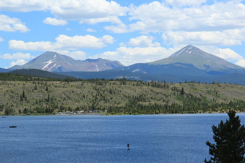
Finally, I reach the ridgeline of the Continental Divide. The conical peak of Mount Guyot towers above, with patches of snow still visible on its northern slopes, colored a rusty red by iron pyrite deposits. This reddish ore stains the mountainside a deep crimson, resembling blood from a fresh tattoo. A scree slope descends from the peak, merging with stands of lodgepole pine below. In the distance, the ski runs of the Tenmile Range flow down the mountains, akin to rivers leading to the sea.
Clouds drift overhead, a chill in the air, and Whitman's words resonate in my mind once more:
> We have now reach’d, penetrated the Rockies, (Hayden calls it the Front Range,) for a hundred miles or so; and though these chains spread away in every direction, specially north and south, thousands and thousands farther, I have seen specimens of the utmost of them, and know henceforth at least what they are, and what they look like. Not themselves alone, for they typify stretches and areas of half the globe — are, in fact, the vertebrae or back-bone of our hemisphere.
Atop Georgia Pass, the Colorado Trail first crosses the Continental Divide, overlapping with the Continental Divide National Scenic Trail — a remarkable 3,100-mile journey from Waterton Lake at the Montana-Alberta border to the Crazy Cook Monument, where New Mexico meets Chihuahua, Mexico. The entire span of the Continental Divide in the Americas stretches nearly 7,000 miles from Cape Prince of Wales in Alaska's Brooks Range down through North, Central, and South America to the Strait of Magellan in southern Chile.
The Continental Divide marks the point where most of America's watersheds flow either east or west. As snow melts and courses down the Divide's slopes, headwaters merge into larger streams and rivers that traverse canyons and valleys, ultimately reaching the ocean. To the west, rivers flow toward the Pacific—like the Colorado, Yellowstone, Columbia, and Yampa. In contrast, to the east, waters head toward the Atlantic and the Gulf of Mexico—the Mississippi, Arkansas, Missouri, Rio Grande, and Platte.
However, the Divide's nature is more intricate than this straightforward east-west split. Several "endorheic basins" exist along the Continental Divide, areas not connected to the sea via rivers. These basins are classified based on their lowest perimeter pass, determining which side of the Divide they fall on. Hydrologists assess how drainage would flow if the basin filled with water, similar to a cereal bowl on an uneven table. Some locations, such as Isa Lake in Wyoming, drain both east and west; the Lewis River flows toward the Pacific, while the Firehole River heads toward the Gulf of Mexico.
Despite these peculiarities, the Continental Divide undeniably stands as the principal hydrological divide of the Americas—the backbone of our hemisphere, as Walt Whitman articulated so beautifully. The Rocky Mountains encompass over a hundred subranges, and in Colorado, the Continental Divide is defined by six: the Park Range, Never Summer Mountains, Front Range, Tenmile Range, Sawatch Range, and San Juan Mountains. The CDNST traverses nearly 800 miles through Colorado's Rockies, overlapping with the Colorado Trail for around 235 miles before continuing into Wyoming to the north and New Mexico to the south.
Alongside the Colorado Trail, I've long dreamed of exploring the Divide. For now, however, I push those thoughts aside, focusing on the journey ahead.
Note: This narrative is an excerpt from my book, The Trail to Nowhere: Life and Death Along the Colorado Trail. It is available for pre-order and will be published on August 24, 2024, four years to the day since I began the journey that inspired it. If you'd like to read the book before its release, you can claim a free copy here. Thank you for reading.